Helioscope Simulations with LiDAR-GIS Data Inform Dual Mode Orientation of Bifacial PV Systems
Outcome/Accomplishment
Researchers with the National Science Foundation (NSF)-sponsored Quantum Energy and Sustainable Solar Technologies (QESST) Engineering Research Center (ERC) at Arizona State University (ASU) completed simulation studies of bifacial (BF) photovoltaics (PV) using dual mode orientation. The study evolved a new methodology combining LiDAR-GIS with Helioscope for assessing site-specific requirements needed by designers to achieve the maximum efficiency gains possible from bifacial PV systems.
Impact/Benefits
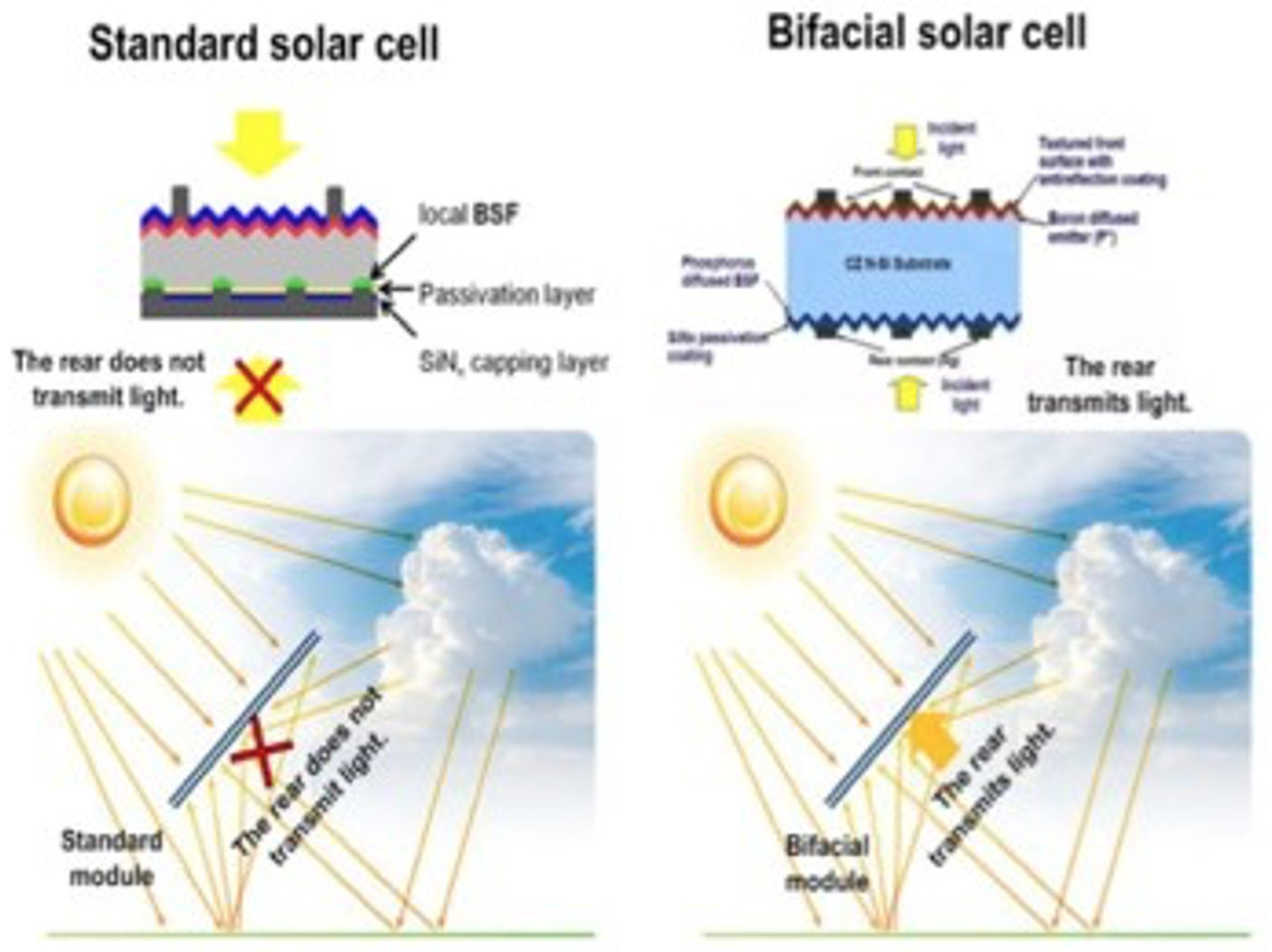
In bifacial PV systems, dual-mode orientations take advantage of the available ground reflectivity (known as albedo) to achieve higher levels of energy efficiency. QESST's combined LiDar-GIS Helioscope method allows researchers to obtain more finely detailed analyses of different solar energy design configurations and installation placements. As bifacial PV systems become more widely adopted, the information acquired through QESST's simulation methodology will be helpful to designers to ensure that applications are appropriately chosen and configured to the requirements and constraints set by their physical placement options. QESST's simulation method helps identify and evaluate bifacial gain increases in specific energy yield (KWh/KWp), compared to standard modules deployed in the same location, configuration, and time, while also pinpointing other critical details needed for bifacial PV systems.
Explanation/Background
To better explore and model the efficiency gains possible with dual mode orientations of bifacial PV systems, QESST supplemented standard LiDAR-GIS methods with the building-level performance analysis software, HelioScope, to estimate municipal rooftop "real estate." In traditional LiDAR-GIS methods, LiDAR measures light detection and range, which is then commonly visualized using ArcGIS, a geographic information system featuring maps and other geophysical details. When LiDAR-GIS methods are used in conjunction with the HelioScope software, however, researchers can more quickly assess site-specific factors that inform bifacial PV installations; this data helps optimize for the most efficient gains from dual-mode orientation.
For example, in the QESST simulations, experimental data from different locations shows a 10 to 30 percent increase in bifacial gain depending on available ground reflectivity (known as albedo). Generally, East-West facing modules require setback to avoid self-shading at low-angle sunlight.
Location
Tempe, Arizonawebsite
Start Year
Energy and Sustainability
Energy, Sustainability, and Infrastructure
Lead Institution
Core Partners
Fact Sheet
Outcome/Accomplishment
Researchers with the National Science Foundation (NSF)-sponsored Quantum Energy and Sustainable Solar Technologies (QESST) Engineering Research Center (ERC) at Arizona State University (ASU) completed simulation studies of bifacial (BF) photovoltaics (PV) using dual mode orientation. The study evolved a new methodology combining LiDAR-GIS with Helioscope for assessing site-specific requirements needed by designers to achieve the maximum efficiency gains possible from bifacial PV systems.
Location
Tempe, Arizonawebsite
Start Year
Energy and Sustainability
Energy, Sustainability, and Infrastructure
Lead Institution
Core Partners
Fact Sheet
Impact/benefits
In bifacial PV systems, dual-mode orientations take advantage of the available ground reflectivity (known as albedo) to achieve higher levels of energy efficiency. QESST's combined LiDar-GIS Helioscope method allows researchers to obtain more finely detailed analyses of different solar energy design configurations and installation placements. As bifacial PV systems become more widely adopted, the information acquired through QESST's simulation methodology will be helpful to designers to ensure that applications are appropriately chosen and configured to the requirements and constraints set by their physical placement options. QESST's simulation method helps identify and evaluate bifacial gain increases in specific energy yield (KWh/KWp), compared to standard modules deployed in the same location, configuration, and time, while also pinpointing other critical details needed for bifacial PV systems.
Explanation/Background
To better explore and model the efficiency gains possible with dual mode orientations of bifacial PV systems, QESST supplemented standard LiDAR-GIS methods with the building-level performance analysis software, HelioScope, to estimate municipal rooftop "real estate." In traditional LiDAR-GIS methods, LiDAR measures light detection and range, which is then commonly visualized using ArcGIS, a geographic information system featuring maps and other geophysical details. When LiDAR-GIS methods are used in conjunction with the HelioScope software, however, researchers can more quickly assess site-specific factors that inform bifacial PV installations; this data helps optimize for the most efficient gains from dual-mode orientation.
For example, in the QESST simulations, experimental data from different locations shows a 10 to 30 percent increase in bifacial gain depending on available ground reflectivity (known as albedo). Generally, East-West facing modules require setback to avoid self-shading at low-angle sunlight.

