

MIRTHE-Map of the P-3B flight track
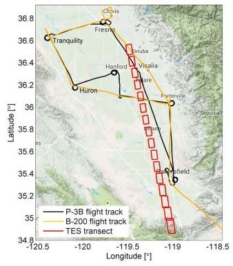
Map of the P-3B flight track (black line), B-200 flight track (orange line) in the San Joaquin Valley, and TES transect (red squares). The vertical profiles were measured by the P-3B aircraft through spirals at the six sites labeled in the figure.
Credit:
MIRTHE
Related content:
Related center: